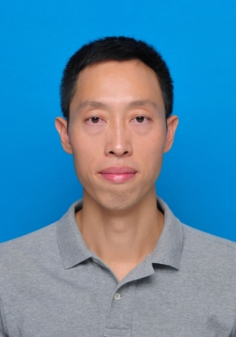
杨海波
郑州大学水利与交通学院教授/博导
研究方向:水旱灾害水利遥感数字孪生水利区域可持续发展
办公地点:
个人简介
杨海波,男,郑州大学水利与交通学院教授/博导,主要研究方向为水旱灾害、水利遥感、数字孪生水利、区域可持续发展。郑州大学水利信息技术学科负责人,数字地球学会中国国家委员会数字减灾专委会委员。
主持国家自然科学基金、国家重点研发项目专题4项、中国博士后科学基金特别资助、河南省重点研发课题、河南省科技攻关(国际合作)等项目20余项。发表SCI、EI及核心期刊论文60余篇,其中一作/通讯40篇,ESI高被引2篇,他引2100余次。授权发明专利10项。中科院1区15篇发明专利10余项。获河南省科技进步二等奖1项。研究成果为等50多项重要工程的高性能需求提供技术支撑。
学术兼职
[1] 国际数字地球学会中国国家委员会(Chinese National Committee of ISDE,简称CNISDE),专委会委员
教学课程
本科生教学课程:
- 地理信息系统(32学时)
- 自然灾害及应对(16学时,每年两学期)
研究生教学课程:
- 遥感与GIS集成(全英,32学时)
- 三维数字水利与BIM(32学时)
- 水利信息前沿概论(学博、工博各16学时)
- 地球信息科学(学博16学时)
科研项目
[1] 主持国家重点研发计划专题“特大干旱胁迫下社会经济系统风险评估”(2021YFC3000203). 2021.12-2024.11
[2] 主持国家重点研发计划专题“全国尺度生态系统关键要素演变规律解析”(2021YFC3200205). 2021.12-2025.11
[3] 主持河南省重点研发计划课题“多源数据融合的黄河梯级水库群灾变机理与失效模式研究” (221111321100). 2023.8-2026.8
[4] 主持国家重点研发计划专题“雄安新区水资源监控预警体系”(2018YFC0406505). 2018.07-2021.06
[5] 主持国家重点研发计划专题“黄河干支流骨干枢纽群泥沙动态调控智慧决策平台”(2018YFC0407405). 2018.07-2021.06
[6] 主持国家自然科学青年基金“基于多智能体的城市化与生态环境协同演化模拟研究”(41101561). 2012.1-2014.12
[7] 主持中国博士后科学基金第五批特别资助“基于遥感的城市化进程中城市空间形态对城市热环境的时空响应研究”(2012T50637). 2012.1-2013.12
[8] 主持横向委托项目:西藏河湖数据资源建设项目. 2021.2-2022.12
[9] 主持横向委托项目:河南省太行山灾害频发区居民点、社会经济数据加工处理. 2025.5-2025.12
[10] 主持横向委托项目:2025年河湖补水水面面积遥感解译分析.2025.5-2025.12
教研项目
[1] 河南省高等教育教学改革研究与实践项目(研究生教育类),主持,2025
[2] 郑州大学研究生教育研究项目,主持,2014
[3] 郑州大学教育教学改革项目,主持,2014
[4] 河南省高等学校精品视频公开课,第二,2014
论文和专著
【论文】
[1] Fei Wang, Qian Xu, Hexin Lai, Mengting Du, Ruyi Men, Rong Li, Ruirui Qi, Haoyu Li, Kai Feng, Yanbin Li, Qingqing Tian, Shengzhi Huang, Yan Li, Haibo Yang*. Detecting the spatiotemporal evolution, mutation characteristics and dominant drivers of vegetation drought in the Yangtze River Basin, China. Agricultural Water Management, 329,2026,110388, https://doi.org/10.1016/j.agwat.2026.110388. 中科院1区.
[2] Yang, H., Dong, Y., Xu, P. et al. Higher Accurate Flash Floods and Debris Flows Simulation: A Hybrid Model Coupling HiPIMS and FLO-2D. Water Resour Manage 40, 304 (2026). https://doi.org/10.1007/s11269-026-04661-9
[3] Yang, H., Wu, F., Dong, T. et al. Sustainable Urban River Network: Integrating the River Ecological Sensitivity Index. Water Resour Manage 40, 257 (2026). https://doi.org/10.1007/s11269-026-04618-y.
[4] Yang, Haibo*.; Wu, Zhengrong.; Dawson, Richard J,; Stuart Barr.; Ford, Alistair. Surface urban heat island variations under the 3-decadal urban expansion in China: patterns and driving factors. Sustainable Cities and Society.2025.130, 15 July. https://doi.org/10.1016/j.scs.2025.106640. 中科院1区.
[5] Xiaosong Shu*, HaiBo Yang*, Fan Wu, Yuhang Zhou, Peng Xu, Xinyi Liu, Jinjun Guo, Yingchun Cai, Jinyu Fan.An integrated spatiotemporal trust and consensus fusion framework for dam safety assessment with multi‐sensor anomaly detection.Computer-Aided Civil and Infrastructure Engineering,Volume 40, Issue 29,2025,Pages 5625-5648,https://doi.org/10.1111/mice.70112.
[6] Haibo Yang, Jiaqi Huang, Xinyi Liu, Peng Xu, Bo Yu, Jinjun Guo, Junhua Li, Yuhang Zhou & Xiaosong Shu. Integration of Morris and GLUE methods for improving massflow-based debris flow simulation. Nat Hazards (2025). 121, 12589–12612.https://doi.org/10.1007/s11069-025-07289-x
[7] Chen, Xuanchi;Wang, Zongmin;Yang, Haibo*.;Liang Qiuhua;Li Junhua ; Cai Yingchun. Assessing Dynamic Flood Vulnerability Variations in Urban Functional Zones Using Dynamic Population Data and a PSO-Based Weighting Approach. International Journal of Disaster Risk Reduction, 116(2025). https://doi.org/10.1016/j.ijdrr.2024.105154. 中科院1区.
[8] Wang, Z.; Liang, H.; Yang, H*.; Yu, B.; Cai, Y. Integration of Multi-Source Landslide Disaster Data Based on Flink framework and APSO load balancing task scheduling.ISPRS International Journal of Geo-Information. 2025; 14(1):12. https://doi.org/10.3390/ijgi14010012
[9] Wu, Z.; Yang, H*.; Cai, Y.; Yu, B.; Liang, C.; Duan, Z.; Liang, Q. Intelligent Monitoring Applications of Landslide Disaster Knowledge Graphs Based on ChatGLM2. Remote Sens. 2024, 16, 4056. https://doi.org/10.3390/rs16214056
[10] Wang, Z.; Hou, L.; Yang, H*.; Zhao, Y.; Chen, F.; Li, Q.; Duan, Z. Spatial–Temporal Assessment of Eco-Environment Quality with a New Comprehensive Remote Sensing Ecological Index (CRSEI) Based on Quaternion Copula Function. Remote Sens. 2024, 16, 3580. https://doi.org/10.3390/rs16193580
[11] Yang, H*.; Cui, X.; Cai, Y.; Wu, Z.; Gao, S.; Yu, B.; Wang, Y.; Li, K.; Duan, Z.; Liang, Q. Coupling Downscaling and Calibrating Methods for Generating High-Quality Precipitation Data with Multisource Satellite Data in the Yellow River Basin. Remote Sens. 2024, 16, 1318. https://doi.org/10.3390/rs16081318.
[12] Wang, Z.; Shi, X.; Yang, H*.; Yu, B.; Cai, Y. Automatic Extraction and Cluster Analysis of Natural Disaster Metadata Based on the Unified Metadata Framework. ISPRS Int.J.Geo-Inf. 2024,13,201. https://doi.org/10.3390/ijgi13060201
[13] Wang, Wusen., Yang Haibo*., Jin Peng., Wang Fei., Liang Qiuhua. Trivariate copula functions for constructing a comprehensive atmosphere-land surface-hydrology drought index: A case study in the Yellow River basin. Journal of Hydrology. 2024, 642.131784. https://doi.org/10.1016/j.jhydrol.2024.131784. 中科院1区.
[14] Yang, Haibo*.; Wu, Zhengrong.; Dawson, Richard J,; Stuart Barr.; Ford, Alistair.;Li,Yunfei. Quantifying surface urban heat island variations and patterns: comparison of two cities in three-stage dynamic rural–urban transition. Sustainable Cities and Society. 2024.109. https://doi.org/10.1016/j.scs.2024.105538. 中科院1区.
[15] Wang, Wusen., Du Qiongying, Yang Haibo*., Jin Peng., Wang Fei., Liang Qiuhua. Drought patterns and multiple teleconnection factors driving forces in China during 1960-2018. Journal of Hydrology. 2024,631, 130821. https://doi.org/10.1016/j.jhydrol.2024.130821. 中科院1区.
[16] Wang, F.; Lai, H.X.; Li, Y.B*.; Feng, K.; Tian, Q.Q.; Guo, W.X.; Quo, Y.P.; Yang, H.B*. Spatio-temporal evolution and teleconnection factor analysis of groundwater drought based on the GRACE mascon model in the Yellow River Basin. Journal of Hydrology. 2023, 896, 165314. 中科院1区.
[17] Wang, F.; Lai, H.X.; Li, Y.B*.; Feng, K.; Tian, Q.Q.; Guo, W.X.; Zhang, W.J.; Di, D.Y.; Yang, H.B*. Dynamic variations of terrestrial ecological drought and propagation analysis with meteorological drought across the mainland China. Sci. Total Environ. 2023, 896, 165314. 中科院1区.
[18] Chen, Xuanchi;Wang, Zongmin;Yang, Haibo*,Ford, Alistair.Dawson, Richard J. Impacts of urban densification and vertical growth on urban heat environment: A case study in the 4th Ring Road Area, Zhengzhou, China. Journal of Cleaner Production. 2023,137247. https://doi.org/10.1016/j.jclepro.2023.137247. 中科院1区.
[19] Chen, Xuanchi;Wang, Zongmin;Yang, Haibo*,Ford, Alistair. Dawson, Richard J. Enhanced urban growth modelling by coupling regional development heterogeneity and noise reduction in a cellular automata model: A case study in Zhengzhou, China. Sustainable Cities and Society. 2023,99. https://doi.org/10.1016/j.scs.2023.104959. 中科院1区.
[20] Yang, Haibo*, Zenglan Li, Qingying Du, and Zheng Duan. 2023. Winter Wheat Drought Risk Assessment by Coupling Improved Moisture-Sensitive Crop Model and Gridded Vulnerability Curve. Remote Sensing. 15, no. 12: 3197. https://doi.org/10.3390/rs15123197.
[21] Yang Haibo, Kong Jialin, Hu Huihui, Du Yao, Gao Meiyan, Chen Fei. A Review of Remote Sensing for Water Quality Retrieval: Progress and Challenges. Remote Sensing. 2022,14(8).DOI: 10.3390/rs14081770.
[22] Fei Wang, Zongmin Wang, Haibo Yang*, Danyang Di, Yong Zhao*, Qiuhua Liang. Utilizing GRACE-based groundwater drought index for drought characterization and teleconnection factors analysis in the North China Plain. Journal of Hydrology.2020,585. DOI:10.1016/j.jhydrol.2020.124849. 中科院1区.
[23] Fei Wang, Zongmin Wang*, Haibo Yang*, Danyang Di, YongZhao, QiuhuaLiang. A new copula-based standardized precipitation evapotranspiration streamflow index for drought monitoring. Journal of Hydrology. 2020.585. DOI:10.1016/j.jhydrol.2020.124793. 中科院1区.
[24] Fei Wang, Zongmin Wang, Haibo Yang*, Danyang Di, Yong Zhao*, Qiuhua Liang, Zafar Hussain. Comprehensive evaluation of hydrological drought and its relationships with meteorological drought in the Yellow River basin, China. Journal of Hydrology. 2020.584. DOI:10.1016/j.jhydrol.2020.124751. 中科院1区.
[25] Fei Wang, Zongmin Wang, Haibo Yang*, Yong Zhao*. Study of the temporal and spatial patterns of drought in the Yellow River basin based on SPEI. Science China Earth Science.2018,61(8):1098–1111. DOI:10.1007/s11430-017-9198-2. 中科院2区.
专利和软件著作权
【授权发明专利】
[1] 杨海波;王宗敏;毛鹏磊.基于多时相遥感影像阴影提取城市建筑物高度的方法. ZL201710077106.5
[2] 杨海波;杜耀;王宗敏.一种结合时空融合与深度学习的遥感水质反演方法. ZL202110633489.6
[3] 杨海波;李其钊;王宗敏;梁黄陶钧.一种基于四元Copula的综合遥感生态指数并行计算方法. ZL202211514932.9
[4] 杨海波;王武森;黄生志.一种多尺度综合干旱指数计算方法. ZL202211030222.9
[5] 杨海波;高诗奇;郭梦丹;吴峥嵘.一种耦合机器学习与GWR 矫正的遥感降水数据降尺度方法. 202211598960.3
[6] 杨海波;史旭洁;吴峥嵘;蔡迎春;盛朋飞;余波;徐鹏;刘心怡;黎杰.一种基于word2vec模型的灾害元数据自动匹配方法及系统. 2024101428778
[7] 杨海波;梁黄陶钧;盛朋飞;罗子仪;蔡迎春;余波;徐鹏;刘心怡;黎杰.一种基于Flink的滑坡灾害多源异构监测数据集成方法. 202410459706.8
[8] 杨海波;吴峥嵘;盛朋飞;梁创恒;余波;徐鹏;晋磊;蔡迎春.一种基于微调ChatGLM2的滑坡知识图谱智能生成方法. 202411377327.0
[9] 杨海波;杜琼英;李曾兰. 基于改进水分敏感确定网格化作物干旱脆弱性曲线的方法. 202310583251.6
[10] 杨海波;陈炫炽;王宗敏;梁秋华.混合深度学习的城市洪涝快速预测模型构建与评估方法. 2024101110619
【软件著作权】
[1] 杨海波,钟宝玲.基于分布式参数率定方法的径流模拟平台. 2023SR0194291.
[2] 杨海波,王治中.黄河凌汛过程推演三维展示平台. 2021SR1779876
[3] 杨海波,钟宝玲.基于遗传算法的SWMM模型参数率定平台.2023SR0205429.
[4] 杨海波,高天天.基于Cesium的暴雨内涝三维动态可视化平台. 2023SR0194252.
[5] 杨海波,高诗奇.基于三种机器学习算法的遥感降水数据降尺度平台. 2023SR0194319
[6] 杨海波,王家威.黄河流域气象干旱管理可视化平台.2023SR0205430
[7] 杨海波,史旭洁.基于深度学习的灾害元数据自动抽取与匹配系统. 2024SR0255903
[8] 杨海波,梁黄陶钧.基于SpringBoot及Flink的多源滑坡灾害数据集成平台. 2024SR0413781
[9] 杨海波,晋磊.山洪与地质灾害数据字典系统. 2024SR0415035
荣誉和奖励
[1]河南省科技进步二等奖,数字图形介质的理论方法研究及工程应用,2013年,杨海波.排10